
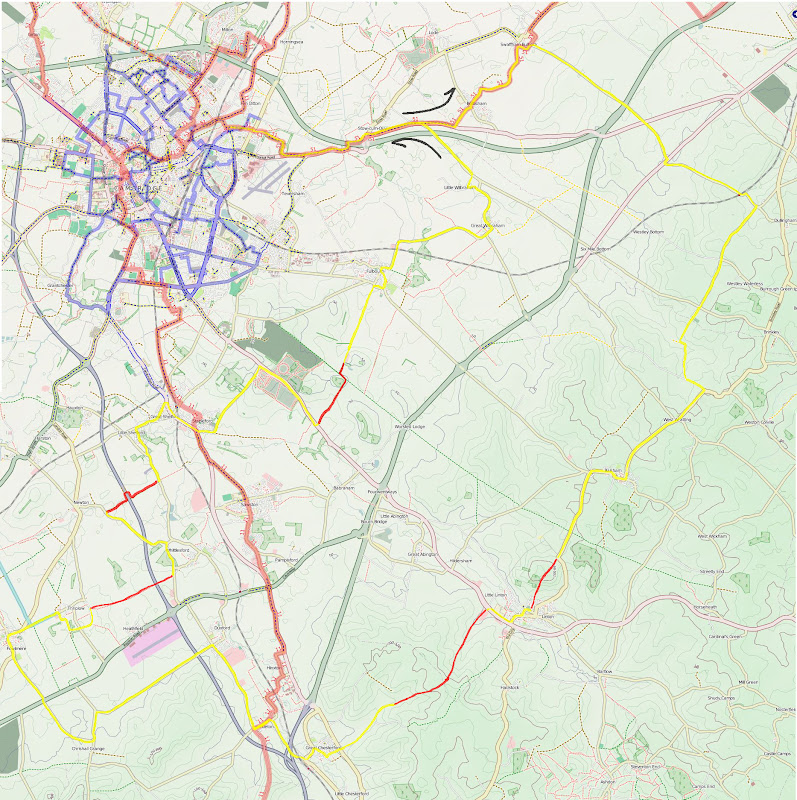
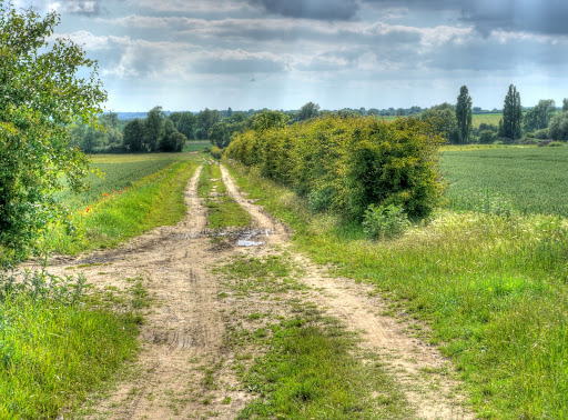
I had a bit more time on Saturday for a cycle ride so I had a look at the map to see what byways and bridleways looked interesting. (I try to get out on one longer run each week - preferably somewhere I have not cycled before.) The OSM map is shown below - you should be able to click on it and get a larger view and download it if you wish. Although different browsers might require different clicks. The route evolved to become a round trip around Duxford taking in a healthy sprinkling of byways/bridleways and country lanes along the way. Whilst en-route I did consider taking the Roman Road (between Cambridge and Balsham) back to Cambridge to avoid all those oily cars. I also considered taking the Icknield Way out of Balsham, however as you can see, in the end I stuck to the roads. As it turned out with the World Cup (Football) on Saturday there seemed to be fewer cars on the roads so it was not unpleasant.
One of the other features of cycling along byways and bridleways is that the roads you use to get to them are generally also very quite and picturesque as well. The worst thing about this route is that it uses the A1307 near Wandlebury Ring - which is an unpleasant road to cycle along. Note the route on the OSM Cycle map does not current show the bit from the end of Cow Lane (near Great Chesterford) through to Linton it is on the OS map as a right of way though.
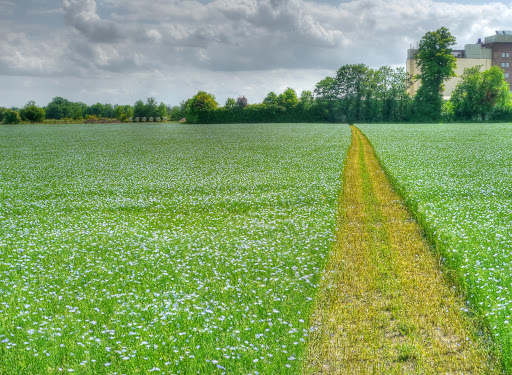
The first photographic stop was on the outskirts of Fulbourn. I stopped to take a picture of a field full of blue flowers - Linseed, also known as Flax. But even before I had walked through the gap in the hedgerow I saw this. My first thought was that it was a member of the Nightshade family. In fact I was pretty sure it was - although I was not sure which member.
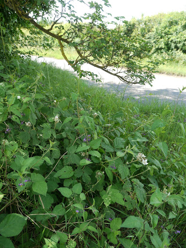
So I took a close-up of the flower to make identification even easier. Unfortunately I was not careful enough in taking the picture - from this angle the flower looks as if it has 4 petals. So when it came to identification it ruled out the Nightshade family which has 5 petals. There are a few sites that can be used for flower identification - I used this one - Botanic Society of the British Isles which asks a series of questions and then presents some possible candidates. I also used this one UKWildFlowers.com - which has a single page of many different UK wild flowers which I also looked over.
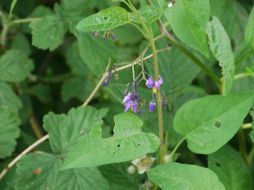
After a closer look I realised that the flower had 5 petals and everything fell into place, it is called Bittersweet or Woody Nightshade (Solanum dulcamara). It is a climber but capable of growing up on its own.
The linseed growing in the field. The line across the field is a footpath. This farmer takes his responsibilities seriously. The building in the background is a Grain Company building, but used to be part of the Railway Freight operations. The Cambridge to Ipswich line runs alongside it.
A closeup of the flower.

My route after Fulbourn took the Babraham Road - which is actually a No through Road which heads towards the Cambridge to Balsham Roman Road. I could have turned left or right on the Roman Road, as I wanted to get through to the A1307 and there are bridleways through in both directions. I chose to go left, although in future I would probably go right. After a short ride on the Roman Road I turned right onto Mile Road (a track) and found a glorious grass "road" stretching off into the distance. The next two pictures show the route, this one is looking back towards the Roman Road.
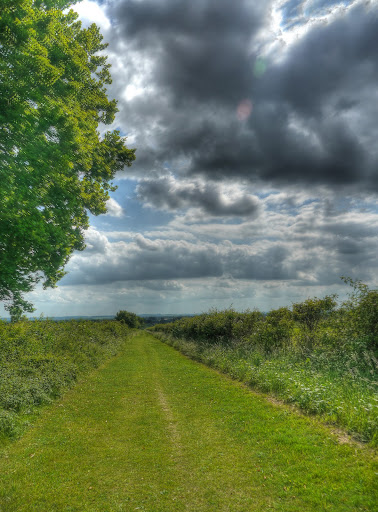
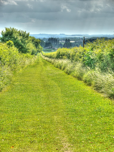
This picture shows the route looking forward (the way I was going). The surface was actually quite firm and so the cycling was easy. The little dot in the distance is a jogger. The only other person I saw on this path.
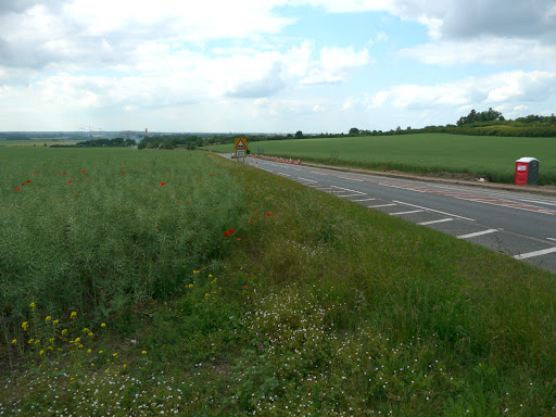
The only shame about the route is that it just "dumps" you on the A1307. An unpleasant and fast road. One I do not recommend for leisure cycling at all. It is not too bad as you approach Wandlebury as there is dual-carriageway and motorists seem more likely to pass with reasonable room. I am not sure that people who drive motor vehicles realise how much draft they create as they whizz by and how it causes unpleasant nad potentially dangerous buffeting. Bicycles wobble.
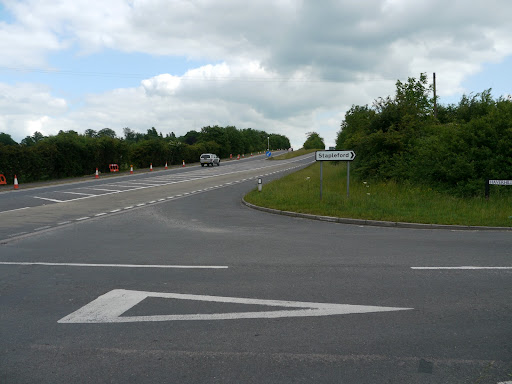
There is a climb from about 40m to 70m before the road heads down into Cambridge. I took the Stapleford turn near the top of the hill. Here is the road from Wandlebury to Cambridge. The "roadworks" are actually where a shared path/cycleway is being built.
A picture taken looking back up the hill, Wandlebury is just over the rise on the left. The shared path seems to be quite a major commitment both in terms of roadworks and encouraging Cambridge inhabitants to cycle out to some of the healthy places to see around Cambridge. (Wicken Fen being the other place to benefit from improved and safer cycle access.) One thing to encourage cyclists is that although it will be uphill from Cambridge it will be downhill back again. Us flatlanders are not used to hills you know.
After winding through the Stapleford and the Shelfords I headed out along the Whittlesford Road and turned off right, along a byway. If you follow the link you will see that Google have captured a funeral procession about to start.
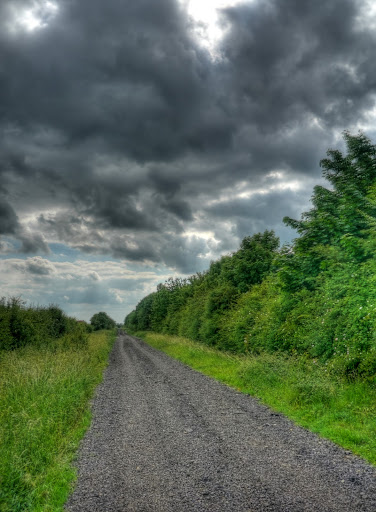
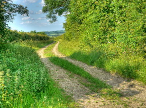
This is the byway. it does not appear to have a name - but is "well-surfaced". Actually it is not too bad on a bicycle (with 25mm tyres) it helps to keep up a reasonable pace though. There is a grass airstrip just over the hedge to the right. The track has its own bridge over the M11 where I met a Land Rover coming in the opposite direction. The track then meets another Whittlesford Road.
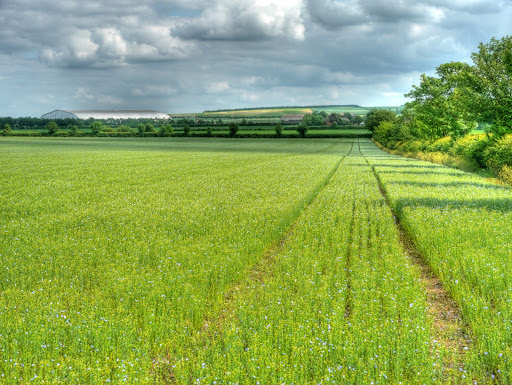
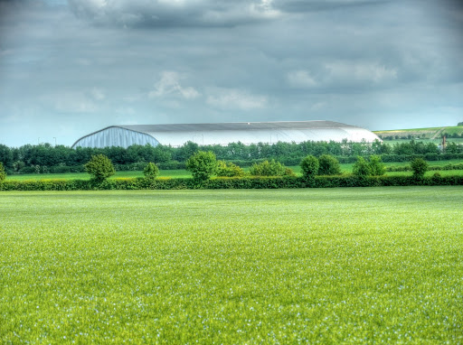
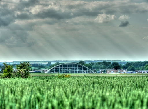
As I was trying to explore a few byways I then headed back over the M11 to Whittlesford turning off onto the Middlemoor Road which becomes the Whippletree Road. I only mention it because of the interesting names. The next track to follow is a right turn as the road starts to climb off Hill Farm Road, just past an electricity box on the verge. This track was the second best bit of track of the day. If was hard-packed mud and went through some glorious fields, crossing the M11 with views of the Imperial War Museum in the distance. It seems the Linseed is a popular crop - seen here growing in the field. The building in the distance to the left is one of the Display Hangars at Duxford. I think that it is the American Air Museum - notable for the huge B52 Stratofortress bomber around which the hangar was designed to fit.
A close-up of the American War Museum Hanger - you have to visit it to really appreciate its size.
Looking back along the track from where I had come. The tower is a cellular phone base-station making sure that all those drivers on the M11 can make/receive their phone calls - hands-free of course.
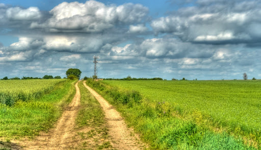
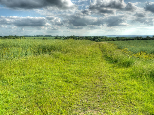
The route going forwards - what is there not to enjoy, beautiful countryside, a decent track surface, no traffic and reasonable weather. checking out the map it appears the track does have a name after all - The Drift - I had not noticed it as it only seems to appear near to Thriplow.
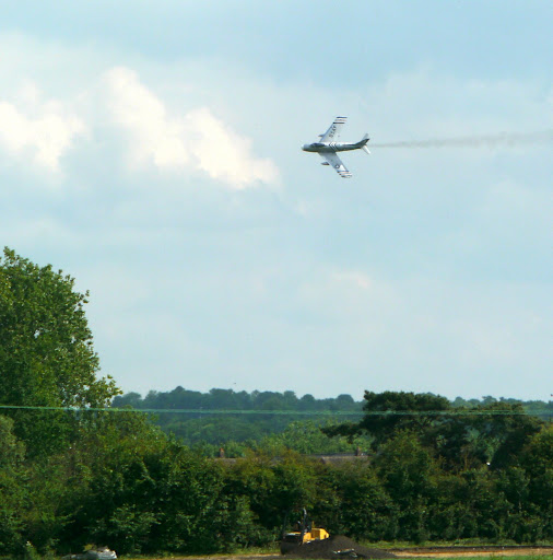
There were also a few planes flying around and about. Although I did not manage to get the Identification markings it does look fairly striking. I think that it is an F-86a Sabre Jet - probably FU-178 - which might or might not be up for sale? Here is a provisional calendar of its planned appearances.
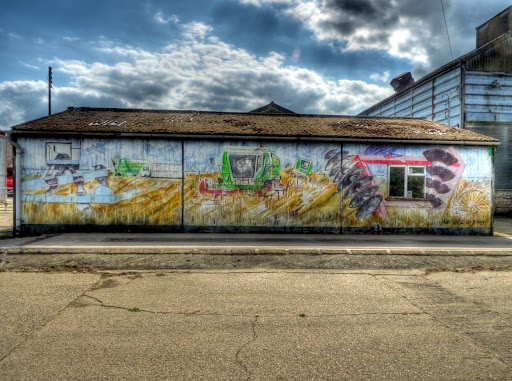
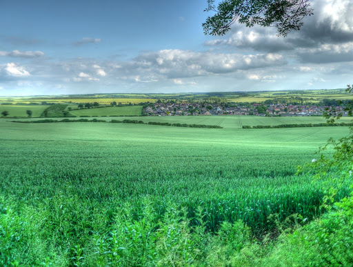
The next settlement I passed through was Thriplow (which I pronounce as Triplow). It is quite a large village - although with a hole in the middle. (The village is spread around fields.) This is Manor Farm (I think) with some agri-art. It appears there are quite a few manors in the manor!
The farm buildings - farming often seems to have a somewhat faded industrial look. I also passed a Cricket Match in full swing as i passed through Thriplow to Fowlmere and then along the Chrishall Road towards Chrishall..
The route looped out around the Duxford Airfield past the recent site of Cereals 2010 - which looked to have been a huge show. It had ended when I went passed but there were still a lot of tents and marquees in evidence. The road I used had been made one way for the duration of the show. Apparently 26,000 people were expected to attend. At one point the road ran parallel with the Duxford runway on its way to Duxford village. (Next time I will use the Ickleton Road, but this time I wanted a "closer" view of the other side of the airfield.
Here is the American War Museum hangar from the front.
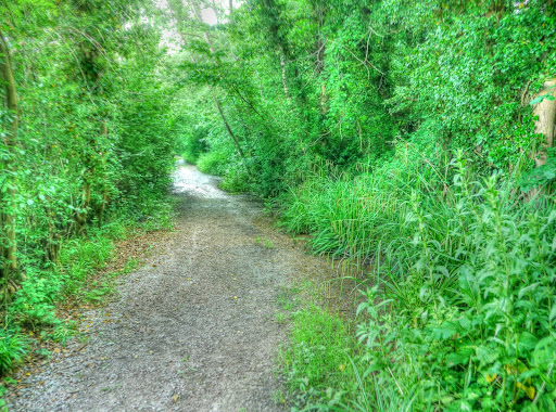
The road from Duxford to Ickleton was a bit unpleasant - not a major road but straight and so there were one or two rather fast cars whizzing by, a bit too close for my liking. In Ickleton I passed quite a few cyclists - I think there must have been an organised ride on passing through. What i was looking for was a road leading to a byway that would take me from Great Chesterford through to Linton. By heading to the High Street in Great Chesterford it brought me directly to Cow Lane. Which at first was a small country road, before arriving at some farm gates indicating Private Road and Public Byway. So far this bit of the route was turning out to be idyllic. There was another gate by Carve Hall Farm and the route become more of a single track up between some large hedgerows. It climbed from around 70m to 110m - not too bad but the track was slippery and there were stingles on each side. Another cyclist or two had also gone by before. It was great - I did dismount a couple of times my thinnish tyres were not quite up to the job - but it felt wonderfully secluded and not flat.
The woodland I climbed up through can be seen in the background of this picture taken looking back towards Great Chesterford. (Not that you can see the village at all.)
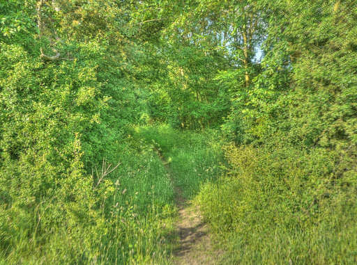
Although there were not huge amounts of woodland around the path did go through a couple of patches. I always get a sense of excitement when cycling into a wood with a path like this one - there are all sorts of possibilities about where it might lead.
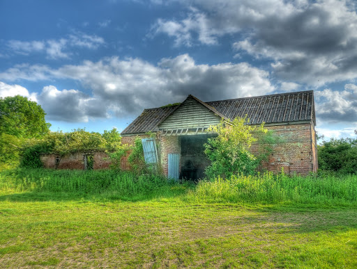
In this case it led out onto an open space with some old farm buildings - this would make for an interesting restoration project - a fantastic place to live - although in the middle of no-where not too far from civilisation - a 4x4 would be helpful in the winter though.
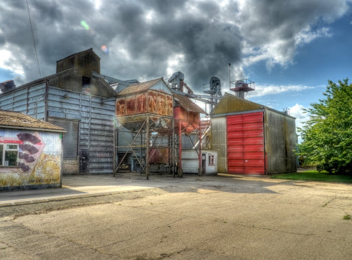
The track leading away was a pretty reasonable farm track past a farm and then passing through the middle of a huge grain-store. The Google Streetview car must have driven up the track for a closer look at the Grain Store - it is much bigger than it looks in the Streetview picture though.
Once again I had to cross the A1307 before heading through Linton to look for a byway which provided a short-cut to the B1052 to Balsham. without even having to check I found it, next to the cemetery on Black Road, it was raining on the day Google took their picture. For some info on Linton - here and here.
The track was pretty reasonable, but quite steep (for a flatlander) and the surface slippery in places - although I did manage to keep going - until I stopped to take a few pictures. The lowest point in Linton is at around 40m, the top of the track was at 110m, so a 70m - not bad. When I stopped take picture of the village (not to rest you understand) there were once again fields of Linseed growing - it is a popular crop this year.
This is the track - as you can see a pretty reasonable surface - this view is looking down the hill.
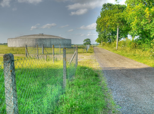
At the top of the hill was a Water Tower a landmark for 70-odd years.
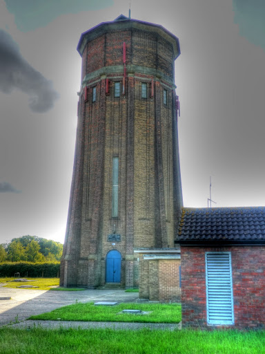
It looks as if a larger, more practical water tank alongside has either augmented or replaced the tower.
At this point I was thinking of taking the Roman Road back - just slightly to the North of where I took this picture. Although I was feeling tired - the climb was harder than I though - living in the Flatlands is not good for cycling stamina. When I reached it I had recovered enough to extend my ride, but took a road route rather than an off-road route.
I think that the Cow lane track was one of the best tracks I have cycled on in the area - I am definitely going to do a route that takes it in again. I think next time I will go the other way - perhaps along the Roman Road, through Linton and then to Great Chesterford and then back along Sustrans 11.
I often bike this area. Daily commute is between Balsham and Granta Park, either past the water tower and pick up the path along the Granta to Hildersham; or straight down the roman road and over the A11; or water tower though the grain store and cut back down to Abington.
ReplyDeleteAt weekends favourite loop is Linton water tower/ grain store / cow lane / chesterford common / bowser lane / ashdon / bridleway back through Linton and home
That sounds a good loop - I must give it a go - what is it like in the Winter? What sort of tyres?
ReplyDeleteNice photos. The hangar in photos 10 and 11 is the 'Airspace' hangar not the American Air Museum.
ReplyDeleteThe one later of the front is the American Air Museum.
Hi Peter,
ReplyDeleteThank you - and thanks for pointing out my mistake - I should have realised (and did once it was pointed out). The American Air Museum dips down at the back.
From yout comment Nov 17.
ReplyDeleteIt gets a quite a bit muddy in the deep winter months and virtually unridable, that doesn't deter me and I often turn up at work plastered in mud. However, my Bontrager Mud-x tyres generally get me through most of the tracks so long as I avoid the worst of it and keep in low gears. I sacrificed a total of 2 drop-outs; 1 derailer; and a few spokes. The mud on it's own is okay, but when the twigs and grit get in the mix it's a nightmare
The most memorable winter ride I had was through the virgin snow past Linton water tower, grain store, cow lane, bowsers and back.
I don't mind muddy puddles, but I am a bit of a wimp when it comes to sticky, claggy mud. The trouble is most of my off-road cycling is on my Marin - I guess I should take out my MTB - no mudguards to get in the way and I have hub gears on it so less chance of damage - except to me!
ReplyDeleteI agree - snow is wonderful to cycle along.