Wednesday, June 30, 2010

Simple Adventures on a Cycle ride from Cambridge to Soham and back

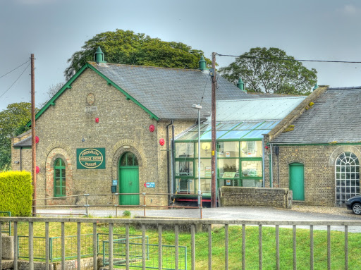
One of the great things about working from home is that you can start work early, dressed however you want. You don't need to start with a shower or breakfast. You can have breakfast during your first break, skip lunch and wahay you've done your bit and there is some gorgeous Summer weather out there just calling for you to ride your bike.


I do not tend to worry too much about getting sun burn - but with the blazing sun I made sure I was protected with sun screen, including my feet. I have some cycling sandals, which provide good foot protection but are open. As a result I have brown "tiger" stripes on my feet - even with the use of sun cream. But before I put on the sun screen lotion there are other important issues. As those who follow cycle racing will know there is a concern that some cyclists are cheating by taking banned performance enhancing drugs. I believe that all cyclists should do their bit and so I test my blood regularly irregularly. Now I was just about to set off on a ride and so time was ticking away. The obvious thing to do is several things at once. So as I was bare footed, muddy cycling sandals and the kitchen floor do not make for harmony, I was able to get ice out of the fridge ice dispenser and into a drinks bottle and at the same time arrange for a piece of ice to fall on my foot and stab me. So I was going to have a cold drink available to me on the ride and I was able to check that my blood was still red. Not being an International Cycling Federation I have to limit my drugs testing to, well, is my blood red and it was.


I think that is the first time I have ever been stabbed by a piece of ice - it delayed me a little as I had to put on a small plaster to avoid the wound rubbing on my sandal. Eventually I got everything together and after applying the sun cream set off. Actually one of the things that delays me is the time from turning on my GPS to it get a satellite lock. In fact the time for the GPS to switch on and get set up is the bulk of the delay so I tend to switch it on before getting other stuff ready. Then when I am ready so is my GPS - me a slave to the machine.


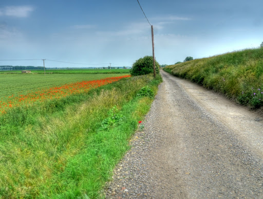
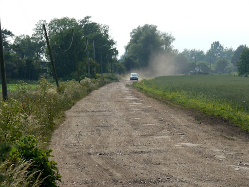
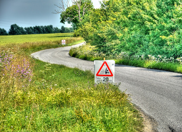
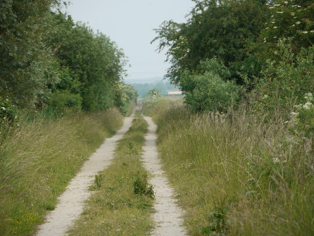
On hot sunny days when I have not looked at a map thinking about where to go I tend to go with the default ride - somewhere over near Wicken Fen. I know my way around and there are tracks and quiet roads where I can get away from traffic. If the weather is exceptionally nice then I tend to head more for tracks than road so as I was cycling out of Cambridge on Sustrans 51 I doubled back onto High Ditch Road and then over the A14 onto Fen Drove Way. The bridge over the A14 is probably the high point of the ride, it is the only "hill" of note. it is easy to whizz down the other side and then you realise that the tarmac surface turns into a gravelly pothole surface - my advice, stand on the pedals and roll with the potholes. Actually avoid the potholes it is easier.


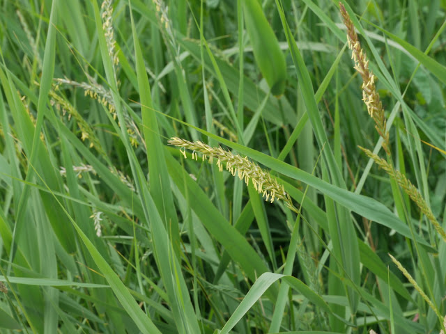
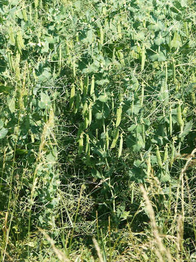
The great thing about going down hills is the potential energy gets converted into kinetic energy - but it never lasts as long as you want and as I slowed down I realised I was passing a coupe more fields full of peas. I had not realised that peas were grown commercially in these parts - I can't remember seeing peas around these parts before - mind you I am taking a bit more interest in nature this year. We aren't growing peas at home this year (spuds, beetroot, chillies, courgettes, cucumbers - but no peas) but when we do we always stick either canes of sticks into the ground around the plants to support them - - these plants seem to be able to support themselves.


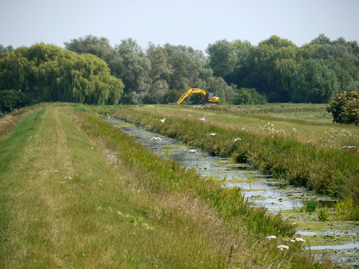
So a picture or two, a sip cold drink and I set off again - there was a car parked further up the track with a chap walking back to it. In my mind I classified him as a fisherman- although I am not sure I saw him with a rod I did think that I will have a look at the map to see what rivers there are in the vicinity when I get back. Answer a few "drains" or ditches. Mind you round here the ditches have real amounts of water in them.


What actually caught my eye was the gun he had propped up against the car - the laws about guns in the UK are sufficiently strict that you do a double-take when you see a weapon in plain sight. When I was younger I (and my friends) used to shoot with air rifles and in my early twenties I did a bit of live ammo target shooting (in a club) - but I thought it would look a bit odd if I stopped to check what sort of weapon he had. So I am not sure if it was an air rifle or "real" - but just a little surreal.


P1130629.JPG


The track then swung round towards the Horningsea Road as I reached it a car turned up the drove. Was this another person coming to join the other chap in a bit of shooting? He waited at the bottom of the track and allowed me to pass by. In my experience very few cars wait, and a few whizz by kicking up dust and stones with inches to spare. It became clear after I passed him (it was a he) he let a dog out and then drove along the track letting the dog follow on. I have seen it quite often around here - walking a dog - whilst driving a car alongside. I would have thought that one of the benefits of owning a dog is that it provides an incentive and an excuse to get out for a walk - especially when the weather is so nice. Of course it could be that the owner cannot easily walk - so who am I to comment?


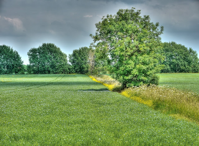
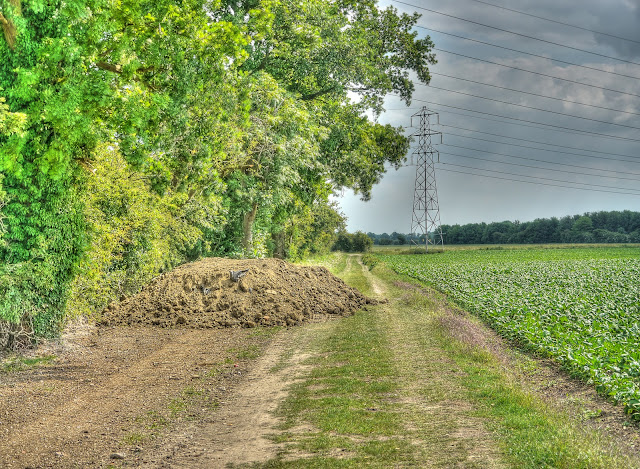
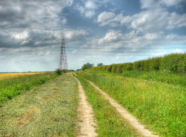
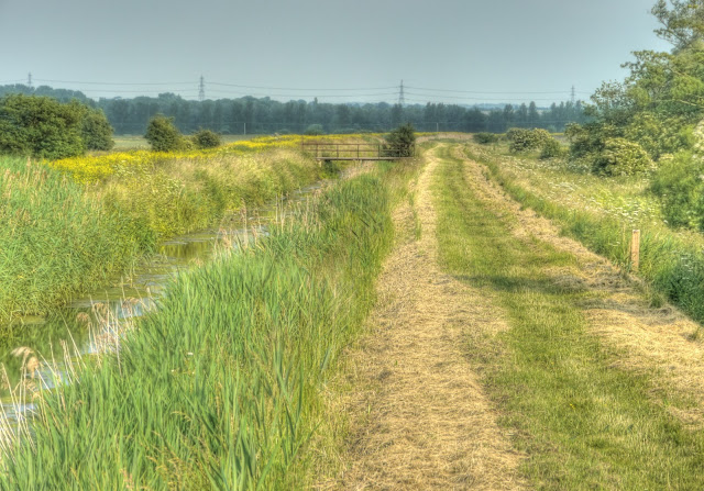
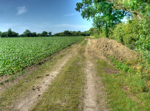
On my map I mark the route from where Low Fen Drove meets the Horningsea Road to Horningsea as being on-road (in yellow). Now they have built the shared use cycling path, even though it does not have markings yet I use it. It is much better than having cars zoom by and it is nice and flat. Then I turn back to the East on the Harcamlow Way just after Horningsea along a gravel track. This then turns onto a grass track along the edge of a field - in fact the the one in the picture. A couple of days ago this pile of earth covered 90% of the width of the track now it only covers 10% - I am still not clear why it was dumped there in the first place though.


P1130630_1_2_3_4_5_6_tonemapped.JPG


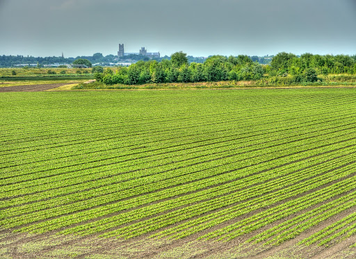
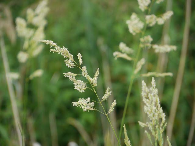
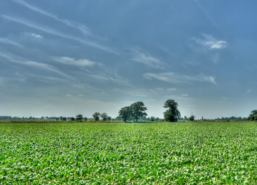
The view from the track was one of green crops, the occasional tree and blue skies with a few wispy clouds. The clouds looked like contrails left by passing jets.


P1130643_37_38_39_40_41_42_tonemapped.JPG


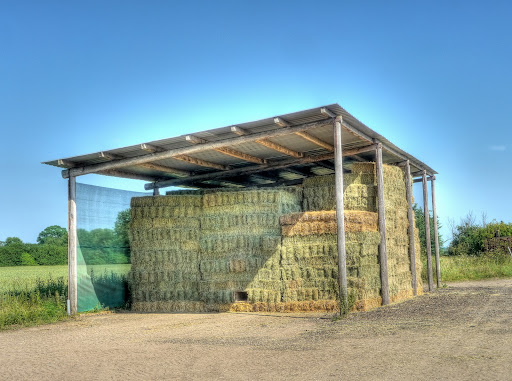
The path cuts through Alicky Farm - whoever runs this farm has already got the hay in - nicely stacked. I wonder if the farmer has made a den and that hole in the middle near the bottom is the entrance? He must be thin if it is!


P1130657_1_2_3_4_5_6_tonemapped.JPG


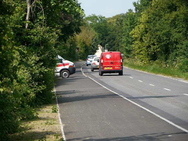
After passing the Farm as I carried along the track a white van passed me - with what appeared to be ambulance markings along side - although the sort you'd get on a Private Ambulance. The only vehicles I normally see on these tracks are farmers vehicles, usually tractors and already I had seen a "gunman" and an "ambulance" - this was turning into a slightly surreal ride.


After passing the "ambulance" a lad on a BMX bike stopped me to ask the way to Horningsea. he was on the right track - but it was not so easy to describe the route as there are very few signposts and you can get confused between byway tracks and other tracks. Anyway I pointed out the direction he needed to aim for. Sometimes I go along the old disused railway line (a permissive NT path) but today I was not in any hurry to go anywhere so carried on the Drove Way to Quy. I then cycled through the village and took the main road - the B1102. I don't cycle far on the road and there is a quieter alternative (via Bottisham) but although the traffic speeds are fast it is not high in my list of unpleasant roads. Most cars gave me plenty of space when they overtook. The level of danger I perceive depends upon the volume of traffic, the width of the road and the straightness. The worst roads seems to be fairly thin and straight with cars that are using it as a short-cut between more main roads.


P1130664_58_59_60_61_62_63_tonemapped.JPG


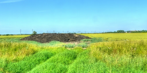
In one of the fields alongside Whiteway drove is this mound of "earth". I think that it is treated human sewage - it has a somewhat different small to cow-muck. In Somerset it was common for farmers to use muck spreaders to spray cow muck on their fields the smell was pretty strong but different. This smell is much less strong but has a distinctive whiff. Apparently more "farmers are turning to human sewage". (another sewage link)


P1130671_65_66_67_68_69_70_tonemapped.JPG


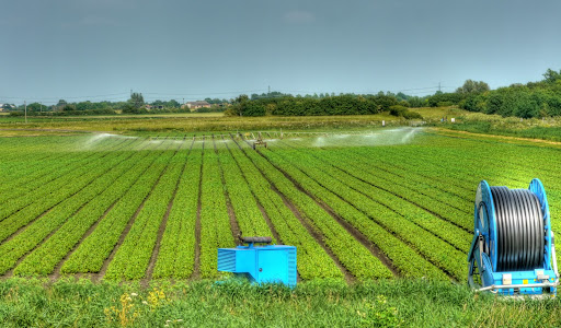
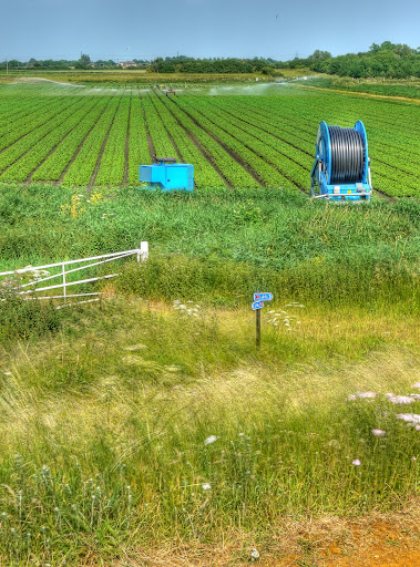
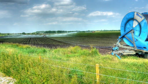
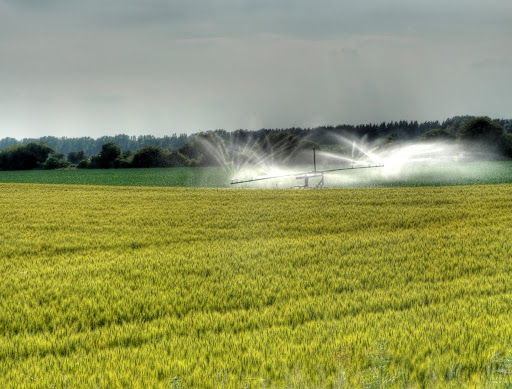
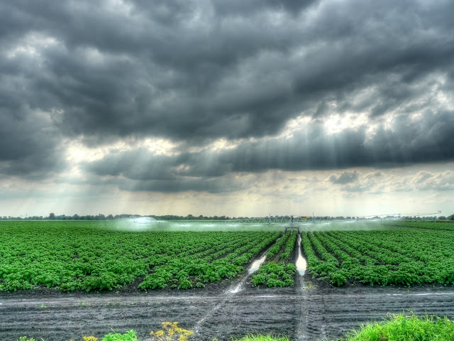
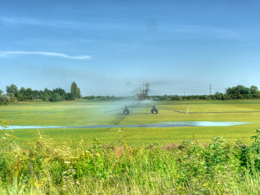
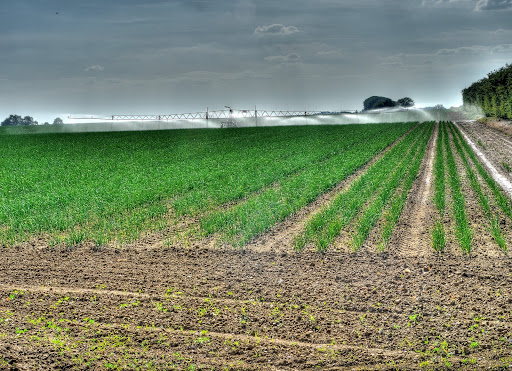
Anyway I was not on it long before turning off through Lode and down to White Fen. After crossing Swaffham Bulbeck Lode I carried on the farm track (a byway) and then turned down a farm track between two fields. (This is not a right of way - but no-one has complained to me - I did once see a van driver who had pulled off for a kip. Here is an important crop being irrigated - it is turf - a "crop" that has become more popular over the last few years. I guess the flatness and soil qualities make it easy to grow and "harvest". The track I took then met with Rail Drove before joining with Whiteway Drove - heading for Swaffham Prior. After a short ride down the road I turned off onto Black Droveway - another track - in the dry this is hard-packed rutted mud - I managed it with no dabs. As I reached the other end of the track there was a traveller caravan parked up. You occasionally get them here, almost as an overnight stop, I said hello to a chap walking back to the caravan and just as I passed a yapping dog chased me. I am not a great fan of being chased (by dogs) when cycling - you don't know what is likely to get tangled up. Normally I just accelerate away - small dogs have small legs. This time I was also having to navigate ruts and mounds and there was no way I could just speed up - so I shouted at the dog - which did the trick.


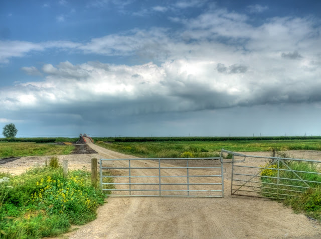
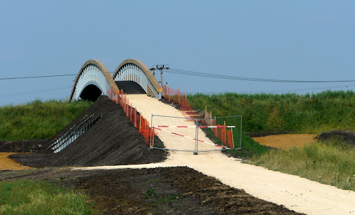
On the outskirts of Reach I then headed for Straight Drove - where I managed to navigate the rutted tracks without having to dab my feet down at all - I was on a roll today. Except when I stopped to take pictures - my balance is not that good. They have reinforced the barriers on the new Reach Lode Bridge - although you can see that it looks as if the netting has been flattened a bit higher on on the right hand side.


P1130673.JPG


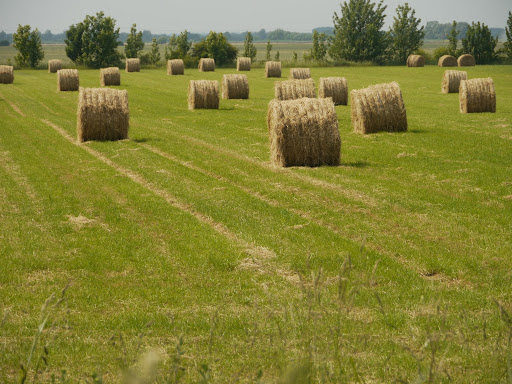
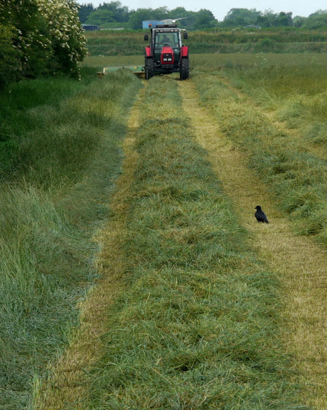
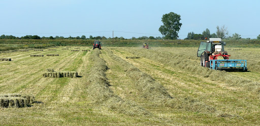
My no-dab success carried on all the way up Straight Drove - where I was pleased to see some traditional hay-making - "like what I used to help with as a boy". Those are what I call bales - things that I could lift as a lad. Mind you the farmer I used to help did not have that new-fangled blue thing which collects a few bales together before dropping them - we used to that bit by hand. You can see that they have three tractors working this field - following the adage - make hay while the sun shines.


P1130677.JPG


The soil in the fields is browner as you get past Upware on the way through to Wicken village. I assume that the irrigation water comes from one of the drainage ditches leading off the River Cam which is not far behind the trees in the background of the picture


P1130684_78_79_80_81_82_83_tonemapped.JPG


I generally take the back road through Wicken Village and join up with Sustrans 11 by turning off the A1123 onto Way Lane and then along Lower Road. The Sustrans 11 route then turns towards Wicken Fen by turning right onto Chapel lane. But as I was ambling I turned left carrying on around the back of the village and down Drury Lane to a byway called Drove Lane. The byway leads to a bridleway (in the shape of a reverse "Z") before becoming a byway again (Bracks Drove) and gets you to Soham.


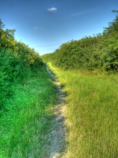
This is how the route looks halfway along the track, near the start of Bracks Drove I think - you can see the Electricity Cables but no pylons. At the moment we have not had much rain and so the track was baked mud and pretty easy to cycle along. In fact I was a little worried that cracks that had opened up along the path might grab the wheels.


P1130698_2_3_4_5_6_7_tonemapped.JPG


The end of the byway (Bracks Drove) and the start of a road in Soham (Mill Drove). The top sign on the left says "Public Byway" the bottom one "Wicken Walks". This bit of the track was slightly more difficult as there were tyre ruts, I managed to cycle along it without having to dab a foot down though. One thing that strikes me is that it is quite common to see telegraph poles and electricity cables along some of these routes (I think). I guess that the convenience of the route, which is why the byway exists, also works for the stringing up of cables.


P1130705_699_700_701_702_703_704_tonemapped.JPG


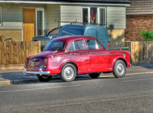
The route into Soham crosses the Ely-Ipswich railway line and then you have to found your way onto the Fordham Road. I had to stop to take a picture of this Hillman Minx - my Dad had one of these when I was a young lad. It had a 1500cc engine but nothing like the power of modern cars. We used to joke that we would have to get out and push it up the hills, Ours was grey.


P1130712_06_07_08_09_10_11_tonemapped.JPG


On the way out of Soham you can cut through a small housing estate near Down Field Windmill on Orchard Row - this brings you out on the A1123 opposite a byway which is a short-cut through to the B1102 to Burwell. It gets close to the Fordham Bypass but the minor country road (Cockpen Road) avoids it. It is also around here that the Cambridge to Mildenhall Railway Line joined and crossed the Ely to Ipswich Line. There is not much sign of it now - if you know where to look you can see the curve where the track swept round on Google Earth, to the East of Lark Hall Farm.


The B1102 is quite a fast road - but also quite wide and so does not feature very high up on my list of unpleasant roads to avoid - having said that I still prefer to turn off at Ness Farm along a byway that becomes a road into Burwell which runs parallel to the B1102 and then runs into the Sustrans 11 route (which then becomes the Sustrans 51) route.


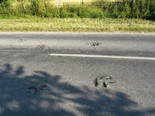
You can tell it was a hot day - the road surface was so soft that a tractor has left marks in the road somewhere between Burwell and Reach (as they also do on the byways). Apparently the degree of damage a vehicle does increases to the fourth power with the axle weight. So if you double the weight there is 16 times the effect (2 x 2 x 2 x 2). That is why cars and particularly lorries should not park on pavements.


P1130720.JPG


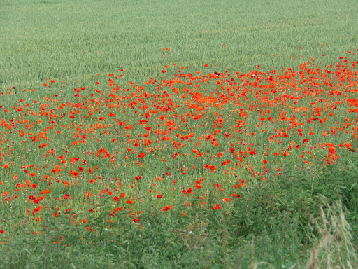
As you can see from the map I detoured off Sustrans 51 at Reach and went via White Fen - it was just too nice to hurry back into the hubbub of the traffic. Whilst cycling along White Fen I had a Serengetti experience - I startled a grazing deer in the Fen and it started leaping high in the air as it bounded around trying to get away from me. Normally the deer I see tend to slip away into the long grass and or crops - this was a larger animal though and if I'd been a tiger I would have definitely gotten the urge to chase it down as it bounded along. But I am not - despite my tiger feet.


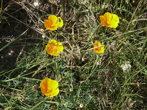
After returning to Sustrans 51 I spotted a few more California poppies growing alongside the route near the Quy Mill Hotel.


P1130627.JPG


This was one of those slightly surreal days - nothing untoward, just a series of events, each one would have been of slight note - but unusual for them all to happen on one ride. Mind you that is what I enjoy about cycling - there is always something to see, whereas it is all to easy to switch off when driving a car and miles pass by without you having any particular recollection of the drive.

Tuesday, June 29, 2010

Pushing those Pedals to Prickwillow and back - with a bit of Conspiracy Theory thrown in!

Once again I find that I am getting behind on my Posts - this is Saturday's cycle ride. I generally try to go out for at least one ride each week to explore an area that I have not been before. Despite the fact I have been living in the area for over twenty years and cycling seriously (for me) for 15 years I still find there are loads of places I have not cycled. When I say explore I don't mean cities and main roads, I like to explore the country lanes, byways and bridleways and there are many of those. mind you not all that easy to navigate on a bicycle. I generally use my hybrid Marin San Anselmo bike with 25mm Schwalbe Marathon Plus tyres. My bike is a few years old, the on in the link is the modern version. I mention the tyres because they are pretty standard tough road tyres, not mountain bike tyres to give an indication that I expect the tracks to be reasonably passable.

Saturday tends to be a good day for a longish ride as I can set off around noon and then do not need to be home for 5 or 6 hours. This give me plenty of scope for a bit of exploration. Although this particular route is one I have ridden before - so bang goes the theory about Saturday being a day for exploring. The reasons for choosing this route were that I had not been out this way for a while and it is fairly easy to navigate - except for the bit that isn't and the bit where my GPS packs up!

Here is the route - straight out of town on Sustrans 51, then turn left at Burwell and take the Sustrans 11 route to Ely. Then the creative bit - head to Prickwillow instead of Kings Lynn (which is where Sustrans 11 goes) and then although not marked as a right of way there is a farm track alongside the River Lark that you can follow South to a place called West Row and then back East towards Fordham before rejoining Sustrans 51 at Burwell. It is a flat route and most of the tracks are pretty good - no deeply rutted mud tracks, except for the last little bit into Burwell. So if it is not windy it can be quite a quick route.


I do not generally find myself taking many pictures along roads I cycle along frequently (Sustrans 51, Sustrans 11) unless there is a difference - in Swaffham Bulbeck there were some tents peeping above the hill - called Windmill Hill - although there is not a windmill there now.


P1130470.JPG

The next village along I stopped again - some nice colours in the vegetation behind the Swaffham Prior village sign. Swaffham Prior has two villages and two churches and yet is a small village (and a water tower - one windmill seems to be missing from the sign).


P1130478_2_3_4_5_6_7_tonemapped.JPG

On my way round the back of Burwell a quick stop again - I have been taking pictures of this field on Weir's Drove during the hay-making - which has now been completed.


P1130479.JPG

In the same spot I stopped to take the hay field there was some White Dead Nettle (Lamium album) peeping out of the verge. It looks like a stinging nettle, except it has larger white flowers and does not sting - which is why it is called "dead".


P1130480.JPG

Something I have not noticed before is that using Streetmap to look at the Sustrans 11 route near Barway on some scales it appears as a Sustrans route and on the 25K it does not. It is not a right of way - but a permissive route which has been negotiated by Sustrans I assume. It is a pretty good way to get to Ely by bicycle though. This is Soham Lode with some repair work taking place. I took the picture from Lode End Bridge.


P1130482.JPG

From the same vantage-point a view across the fields towards Ely - with Ely Cathedral in the distance.


P1130501_495_496_497_498_499_500_tonemapped.JPG

Same position - this time looking West (ish) along the River Great Ouse as small boat comes into view around the bends in the river.


P1130510.JPG

Yes - same position (obviously looking in different directions), I am not sure if this is Thetford Fen Pumping Station or just part of the Lock system connecting Soham Fen to the River great Ouse.


P1130517_1_2_3_4_5_6_tonemapped.JPG

(SP) with the growing season upon us the farmers cannot afford to let their crops go without water - a good job there is a lot of water being drained from around here really. (Not a coincidence I think,) The blue box on the left is the diesel-powered pump with the hose reel on the right. The irrigation unit can be winched along automatically - I think - I have not hung around for long to watch.


P1130524_18_19_20_21_22_23_tonemapped.JPG

The same direction, but this time a slightly wider angle to include the Sustrans 11 signs in the foreground. The cycle track is down the slight hill nearer the sign, but a track rises up to the Pumping Station.


P1130538_2_3_4_5_6_7_tonemapped.JPG

A little but further along (yes I have actually moved along a bit) yet more irrigation taking place. I think the reel draws in the hose and so pulls the irrigation unit along.


P1130539_40_41_42_43_44_45_tonemapped.JPG

Once I reached the end of the cycle track and joined the A142 I went pretty much straight across along Queen Adelaide Way. depending upon the time of day you hit this road it can take a while to cross - be patient after a while cars will stop for you. This is a view looking back Queen Adelaide Way to the silhouette of the Cathedral. It reminds me of a medieval castle.


P1130546.JPG

The road, QAW, passed under one of the many railway lines around here before turning right onto the Prickwillow Road where the road crosses a level crossing at an angle -be careful - I always turn slightly to increase the angle that my wheels meet the tracks - it does mean that you tend to move towards the middle of the road though. In Prickwillow you can see the Drainage Engine Museum just before crossing the River Lark. Then you take the next right alongside the River lark - it is marked as a road - Lark Bank and has a tarmac surface for part of the way.


P1130555_49_50_51_52_53_54_tonemapped.JPG

After a while the tarmac surface becomes a gravel road - and this is the bit I am not sure about in terms of right of way. It is fine for cycling along - just not very fast. I have not met many vehicles along this track in the times I have cycled along it.

One of the things that mazes me is how clear of weeds most of the fields are - it shows a dedication to the use of the right weed-killers I guess. However every now and then I do pass fields with weeds in them - like this field with a sprinkling of poppies - perhaps it was a bit windy when the field was sprayed or the farmer's mind was wandering and he missed a bit.


P1130562_56_57_58_59_60_61_tonemapped.JPG

I thought this was an old farm building - but am not sure on looking at the photograph now.


P1130569_3_4_5_6_7_8_tonemapped.JPG

I have no idea what the presence of the poppies does for the crops - presumably the plants compete for nutrition and it gets in the harvest? It looks nice though!


P1130571.JPG

Now this looks like a flower that should be easy to identify - well not for me - some sort of Bellflower perhaps? For now I will call it Creeping Bellflower (Campanula rapunculoides) which looks the closest - this precise variety is not in my Collins Guide to British Wildflowers unless Campanula rapunculus counts - no a quick check of Wikipedia - the two are different.


P1130573.JPG

A bit further along the track alongside the River Lark - it is a pretty reasonable gravel track, although the sand was a bit "sucky" here.


P1130587_1_2_3_4_5_6_tonemapped.JPG

How about this for a desirable 4-bed residence? On the other side of the track a Planning Application has been pinned to a post. An interesting location - I wonder if the River Lark bursts it banks very often? A quick check of the Web shows that there have been flood warnings associated with the river, but I did not check where. The top plaque indicated the building was built in 1944 by the Mildenhall Drainage Board, I can't quite read the plaque underneath.


P1130601_595_596_597_598_599_600_tonemapped.JPG

Just after passing the old pumping station I took a gravel farm track off to the left. You pass a farm and a house, I think. There were some people about saying goodbye to some people in a car - they nodded pleasantly as I cycled by - no irate farmers here.

At this point the route is fairly close to RAF Mildenhall, currently playing host to the USAAF. It is not unusual to see fighters and fuel tankers (of the aeroplane kind) flying around. In fact they used to host a fantastic Air Show each year - you could use US dollars to buy things such as burgers and cold drinks during the show - but the show was cancelled some years ago for operational reasons. Concorde flew in one year, the passengers got off and watched the show and then flew off at the end. This plane seems to be civilian - extraordinary! The noise - what a rendition!


P1130602.JPG

Like farmland all around here there are a few disused buildings.


P1130609_3_4_5_6_7_8_tonemapped.JPG

This bit of the route has probably got the worst surface - it is bumpy rather than impassable though. The car in the distance was the one being "waved goodbye". Despite me stopping a couple of times it did not catch me up - the road surface is harder on cars than on bicycles. The track is Fodderfen Drove - and at around 0m above sea level - the fields are below sea level in places.


P1130610.JPG

The track then joins with a road - Cook's Drove - ( a right turn) which passes the Mildenhall Stadium where you can go to watch Banger racing. You can see the Air Force base occasionally on the right hand side of the road with planes and hangars. On the left side of the road there is farmland with this unusual irrigating machine spraying away.


P1130618_2_3_4_5_6_7_tonemapped.JPG

The road then gets to West Row a small village in Suffolk - where the road seems to wiggle around and I get confused as to what direction I should head in - well I did the last time I cycled through here and it happened again this time. Essentially I expected to head South before reaching the Freckenham Road and then turning West - back towards Cambridge. The problem is that as the road wiggles in West Row I get confused and expected to head East sooner. I did ask some guests who were leaving a large-age birthday celebration, but they weren't locals and were not sure.

So I has a quick scan using my GPS of the area. It only has a small screen and you either have to move the map around at a high resolution or zoom out and you can't see anything but major roads. Whilst doing this it went wrong. My GPS has only gone wrong in this way once before, it basically lost the map and that was, yes you've guessed it around here. I suppose there could be problems with interference form the powerful radar and radio signals that get generated by the airbase. Maybe they deliberately jam GPS trackers. the reality is that it was because I was trying to move the map around and there is a systematic problem with the software. Most people, including me, probably don't move the map around on the screen trying to find where to go - it isn't really suited to that type of operation. But when they do it causes some latent software bug to come out and bite you.

In my case I fixed it by turning it off and on again - the map was then restored, but I forgot to start the tracker, so that record is missing the last chunk of the journey.


P1130625_19_20_21_22_23_24_tonemapped.JPG

Although it was not really windy, what wind there was seemed to be in my favour and the journey home was quite quick - back through Fordham and then before reaching Burwell I took a byway near Ness Farm which reaches North Road in Burwell where Sustrans 51 meets Sustrans 11 and the way I took back to Cambridge. I did have a car pull out in front of me in Burwell near the Co-op shop - it can be chaotic there sometimes.

Another quick look at recent Cycling reports that have caught my eye

As is often the case I get behind on my posts - life is for cycling (and a lot of other nice things of course - oops my wife was reading over my shoulder ;-) and every now and then I write a bit for my blog about my cycling. Generally with each post I start with a bit of cycling-related Internet news - but when I am behind on my Posts the news tends to get left out. What this means is that over time my Browser acquires open windows over the various news items that have caught my eye, waiting to be blogged about and then closed and forgotten. There are now 8 windows open with things that caught my eye - so it is time for a "special" post - no pictures, no cycling routes - just a few bits and pieces of news.


Now I think that the Threat of Global Warming is real - I also think that we need to reduce our footprint and like the idea of re-cycling and also cycling along decent tracks. This report seems to tick quite a few of those boxes: "Old printer cartridges turned into bike path". (Perhaps the young printer cartridges turn onto the Motorways.) Now I have no idea quite how efficient it is to produce, or what the wear characteristics are like, or even what it is like in the rain and ice. what I do like is the idea that it is worth focusing on producing better bike paths in order to attract more people to the health and ecological benefits, to name but two, of cycling.


Unfortunately, with cycling there is nearly always some sad news to report as well. Actually I am not sure that this involves cyclists- just the cycle route - "Climber finds body in Bristol beauty spot". The body was found on the route of a charity cycle ride - but is not considered suspicious. I think that I am perhaps sensitised to reading stories that have a cycling link "Pensioner cyclist hurt in Lurgan attack". It appears a cyclist was mugged in the early hours of the morning - interesting to see how the BBC News start the headline with "Pensioner cyclist" - would it have been a 40-year-old man walking then would they have started with "Middle-aged pedestrian". Maybe, maybe not - I guess words are chosen for their news value, fewer cyclists get mugged than pedestrians - so it is news?


Although cyclists getting attacked seems to be happening more often, if my non-statistically sound look at the news is to be believed. In Cambridge: "Cyclist is injured after football fans ram bike". - although if you read the report it could have said "cyclist is injured after cyclist rams bike" - but that looks rather odd and anyway football is topical at the moment - or was, for England, when the article was written.


Despite the fact, or maybe because Cambridge is the "stolen bike capital" of the UK we do get regular reports on this issue: "More bikes are stolen in Summer". It also reported on a survey of the bleeding obvious percentage of cyclists that only cycle to work in the Summer. (32% if you were wondering and could not be bothered to click the link.) To be fair the report suggests that the increase is due to the increase in Summer cyclists along with a shortage of secure cycle parking. It would be interesting to know what those 32% don't cycle in the Winter - cold, wet, windy, dark, dangerous - maybe I know already.


So where might it be a secure place to lock up a bicycle, next to a Police Station maybe? Well the answer appears to be no - "Cycle taken at police station", and by the way the lock was also taken.


Talking of Police - it seems that a common "policing tactic" is to have a blitz on a problem, cyclists on pavements are a perennial favourite. "Police target level crossing to stop motorists running barriers" implies the Level crossing jumpers are next on the list. Frankly I am amazed that people do such a thing - trains can't swerve out of the way you know. Why is it happening more - the standard answer might be our roads are congested we need more roads - perhaps we ought to look at the other factor - there might just be too many motor vehicles using our roads?


Talking of roads: "Scottish road causalities 'lowest in 60 years'" looks to be good news - although it does not suggest that there are fewer accidents - just fewer deaths and casualties - so it might just be bigger beefier cars with airbags and the like. Less good was that situation with cycling casualties - 10% more were injured in '09 (just over 800) compared with '08. There was a drop in cycling deaths from 9 to 5 though. However without some background data these facts are a little difficult to analyse - had there been a change in traffic levels or a shift to different forms of transport. Motoring to cycling perhaps! Indeed the footnote suggests that cycling injuries are at a ten year high. I know lets ban cycling - that'll cut the number of casualties!


No I know it is not the right answer - it worries me that that is how some people think though.

Sunday, June 27, 2010

Summery Fen Cycling - lots of growth - cut grass and irrigation

After the miserable weather of last Saturday it seems that once again Summer is back here in the Flatlands of East Anglia. Everything seems to have turned green and is growing profusely and having been off my Hybrid for a few days it was time to take to the tracks around Horningsea and Lode again.


One of the challenges for shorts wearing cyclists at this time of year is avoiding the stingles and this is not just on the more remote tracks and byways around the County. Here is Sustrans 51 where it connects Fison Road with the cycle path through to the Newmarket Road Park and Ride site (and beyond). As Summer progresses the paths become more like tunnels and if you look closely at this picture there are stinging nettles on either side of the path down at the bottom. To be fair I have not been stung going there there so far and I do like to see the wild plants being allowed to grow. If I wanted a more industrial scene I would cycle on the paths alongside the roads. I guess what I would really like to see is a wider path, with a width more suitable for two cyclists to be able to pass each other safely. This would also reduce the conflict between pedestrians and cyclists as well I think and then loads of wild flowers and plants on each side.


P1130322_0_1_tonemapped.jpg


Talking about conflict - yet more surface dressing of the road - there is an Urban hymn - "we tar the roads and scatter the good chippings all around". Then we stick a few signs for drivers to ignore and watch those who own their vehicles cringing as a non-driver owned vehicle (alright white van man) shoots by. This was taken on High Ditch Road where High Ditch Road meets Low Fen Droveway - just by the bridge over the A14.


P1130347_1_2_3_4_5_6_tonemapped.jpg


I took the quickest way off the newly chipping'd road along Low Fen Drove Way - there are still traffic cones in place of the missing drain covers on either side. My theory is that the drain covers were stolen for sale as scrap metal! It seems that now the crops in the fields are busy growing the local farmers have turned their attention to irrigation and flattening their farm tracks. This is Low Fen Drove Way shortly before it reaches Snout Corner. The last time I cycled along here, maybe a couple of days ago it was solid rutted mud. The ruts were not too bad - it needed a small amount of care on my Hybrid (25mm tyres.) This time around it appears to have been flattened and the ruts are all gone - as a result the surface is loose dried-mud-gravel. In places the mud is quite powdery and grabs at the bike wheels, in others there are large lumps that knock the wheels. It does not need much more care - but a lower gear is better and watch our for the quick-dust sucking your bike wheels down.


P1130354_48_49_50_51_52_53_tonemapped.jpg


Yet another Linseed field - not quite as advanced as some of the others in the area - in the shade of the tree there seemed to be a concentration of blue flowers - although it is not that obvious from the picture.


P1130361_55_56_57_58_59_60_tonemapped.jpg


At the end of Long Drove you have to stop for the Horningsea Road. As I waited at this "junction" for a gap in the traffic so I could turn right onto the unfinished shared use cycle path a car and van appeared to want to turn down the Drove - except they didn't they wanted to use the entrance as a lay-by and as far as they were concerned I was in the way. The trouble was it was not a lay-by and so they obstructed my view of the road - making it almost impossible for me to see whether anything was coming down the road. As I was trying to cross you could see the drivers getting impatient as they really wanted to stop in the "lay-by" for some nefarious purpose no doubt. It goes to show that some people just don't put their brains into gear when they are behind the wheel of a motor vehicle. (To be honest that sometimes happens with cyclists as well - they just don't hurt as much when they hit you compared with a car or white van.)


Here is a Google Streetview Link of the place where Low Fen Drove meets the Horningsea Road - there is what appears to be a bus shelter alongside as well - although no signs of a bus stop. I have never seen anyone waiting for a bus here.


The new cycle way is great - see what I mean - wide enough for two cyclists pass or a cyclist to pass pedestrians. (I wonder if it will have markings down the middle for cyclists and pedestrians to ignore?). Unfortunately you always get someone who considers the pavement (or cycle path) as a convenient parking space - like this van. This is clearly selfish behaviour and worse, it also deters people from using the path for its intended purpose.


P1130362.jpg


I generally take the Harcamlow Way just to the North of Horningsea and follow it round past Alicky Farm towards Quy. What was I saying about selfish motorists - it is a good job I am riding a bike - is this for more track repairs?


P1130369_3_4_5_6_7_8_tonemapped.jpg


As I was cycling from Lode to White Fen there was an interesting crop growing in the fields


P1130370.jpg


I think that it might be Corn Chamomile (Anthemis arvensis) - but it is difficult to distinguish from other Mayweeds and could also be Scented Mayweed (Matricaria recutita) as the leaves look more like the latter than the former. I will have to try smelling it next time I go past.


P1130377.jpg


I also spotted some more of the Tufted Vetch growing by the side of the track (Straight Drove) between Reach and Upware.


P1130379.jpg


The farmers had also been out performing their civic duties by cutting the the plants down alongside the byway (Straight Drove) I wonder why they have only cut the grass on one side? Perhaps the next time I cycle along there it will have been cut on both sides.


P1130386_2_3_1_4_0_5_tonemapped.jpg


There is a field of potatoes on the left side of Straight Drove (looking North) the plants have shot up recently and are getting the correct level of irrigation is important.


P1130407_1_2_3_4_5_6_tonemapped.jpg


Opposite the Spud field is the new Reach Lode Bridge - part of the new Lodes Way route. This whole build seems to have been pretty slick. From sorting out the small country lanes for the large cranes through to building the bridge - the site is now cleared. Although the job isn't finished until it's finished - some railings will still need to be put up on either side of the earth ramps.


P1130414_08_09_10_11_12_13_tonemapped.jpg


Straight Drove carries on as a mud track for a while - I can normally cycle along it without too many dabs of my feet unless I choose the wrong rut to cycle along and need to climb out of the same rut (with a dab). At the Upware end it is Harrison's drove and is a heavily broken tarmac road - easier to cycle but with quite a lot of loose gravel and so not so much fun. As I cycled along there was the smell of fresh cut grass in the air. This was not verge-cutting - this was a field being cut for hay. It is a smell that takes me back to my childhood the field in front of the house was often used for hay and we would help the farmer - mainly to get a ride on the trailer.


P1130423.jpg


I cycled through Upware and back through Wicken Fen and along another Harrison's Drove - only not the same one as before. I did have an interesting moment on the road into Wicken (A1123) before I turned off down Way lane to the back road into the village. As I was cycling along there was a stream of cars, headed by a lorry coming towards me I car poked its nose out - saw me and then overtook a few cars and the lorry. Am I just a wimp or is there something really unnerving about a car driving at 60+mph towards you on your side of the road?


Anyway back to the two Harrison's Droves they run in parallel and are about 0.5Km apart - they liked the name so much they used it twice? The Harrison's Drove near to Wicken Fen is an old concrete track that reaches Wicken Lode. The concrete is also quite cracked and so is fairly bumpy but a popular place for dog walkers who park their cars at the bottom. As this is NT land the verges are not cut quite so ruthlessly (sorry with such Civic Pride) and you could see several varieties of grass with pollen.


At my small rural primary school (60 kids from 5-11) we had two classes and as well as Maths and English we used to learn the names of the local wild flowers and have flower tests. Various flowers would be distributed around the room and we had to name them. As far as I can remember I don't think we included wild grasses in those tests. So my guess is that this is Common Couch Grass - but (Elytrigia repens) - but I am less certain than I am about the flowers - and I am not that sure on quite a few of those.


P1130424.jpg


To make it more difficult I also took a picture of a different grass growing alongside - my guess - Rough Meadow Grass (Poa trivialis). The Wikipedia link implies that it is a bluegrass, in the US anyway.


P1130425.jpg


The view down Harrison's Drove with Burwell in the far distance. The blob of orange in the path is someone walking their dog. Although there are no formal parking spaces down at the bottom it is not uncommon to see a few cars left on the verges or blocking CockUp bridge.


P1130426.jpg


On crossing Swaffham Bulbeck Lode on the way into White Fen - I stopped - yet more grass-cutting has taken place - mind you this is supposed to be a path.


P1130461_55_56_57_58_59_60_tonemapped.jpg


One thing about this weather it is bringing out the cyclists I see quite a few around the Fens - including three in White Fen - they were not together - or rather I think they were together but had spread out a bit. The lead cyclists had stopped at the picnic tables in White Fen, I assume to allow the other two to catch up. The Lodes Way is getting used - despite not being due for completion for a while - well done to those involved in making the Lodes Way happen.