
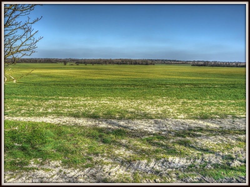
Sunday, 16th March 2014: If you look at the map (2nd picture) then really this ride is nothing like a circle. I suppose I could have made it more of a circle if I had taken a short-cut to Fulbourn via Teversham, but I didn’t, it was a bit of a meander.
I chose this ride, partly as I rode it and partly to check out various places along the route. There is a lot of development going on around Addenbrookes for instance. Also there are road works around the Girton Interchange.
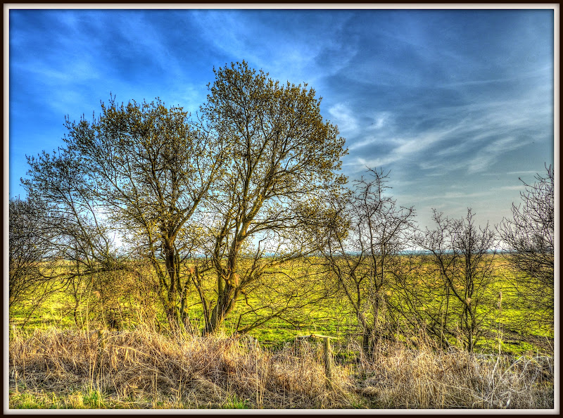
I also wanted to check out this Horse-chestnut tree (Aesculus hippocastanum) in Great Wilbraham. It seems to me that this tree is one of the first deciduous trees to spring into leaf in the Cambridgeshire area. As you can see, by the 16th of March it was pretty green, ahead of most trees in the area.
First Deciduous Tree in Leaf in Cambs
A Horse Chestnut in Great Wilbraham

Here is the link to the Bike Route Toaster map, you can also click on the map to take you there as well. It is just under 60Km in length with one moderate hill out of Fulbourn to around 70m and down, and then a second rise near the American Cemetery (40m).
Although, for the most part the ride is either on country lanes of cycle paths there is a dangerous crossing at the Girton Interchange.
A ride around Cambridge

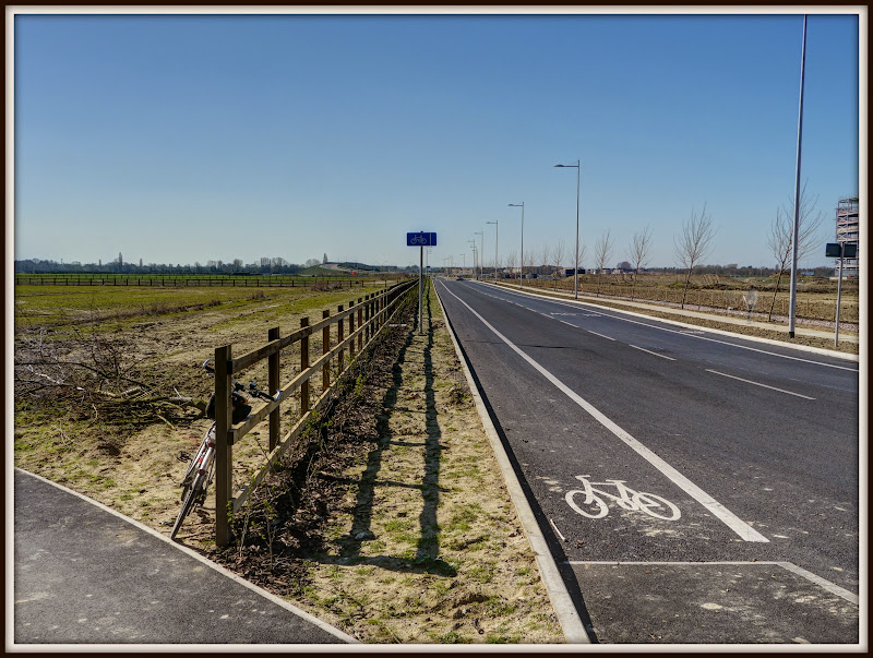
It doesn’t seem that long ago that I cycled along the Addenbrookes - Great Shelford Cycleway – well a new road has popped up – Dame Mary Archer Way. As you can see there MCLs on each side (Mandatory Cycle Lane). However the NCN11 cycle lane separates and runs its own course, which is a good thing. To truly boost cycling in the UK we need to encourage cyclists by providing high quality routes that are both direct and with some separation from the motor traffic, particularly for longer journeys.
Dame Mary Archer Way
I don’t know if there are plans to build in all the available spaces, but for now the cycleway takes a more scenic route.
Addenbrookes – Great Shelford Cycleway

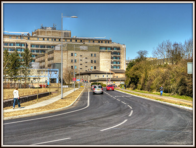
And just for completeness the view back towards the hospital. Given how cycling is viewed as one of the key ways in which the UK might tackle obesity it really is a shame that the roads weren’t built with cycle lanes with a physical separation from both the roads and the pavements.
Dame Mary Archer Way
As it happens it would have been quicker for me to take the DMA Way, (Direct memory Access!). However I was cycling for pleasure not speed. I then headed down Francis Crick Avenue, that was closed for roadworks. I wasn’t clear whether the closure was intended to stop cycles as well. So I cycled down to the CGB link. Which doesn’t currently appears on the OSM map, except as a cycle track. As I approached the CGB link I saw a car start to drive up it, having been fooled by the road closure, the driver realised that they would have problems and reversed back and towards Robinson Way.
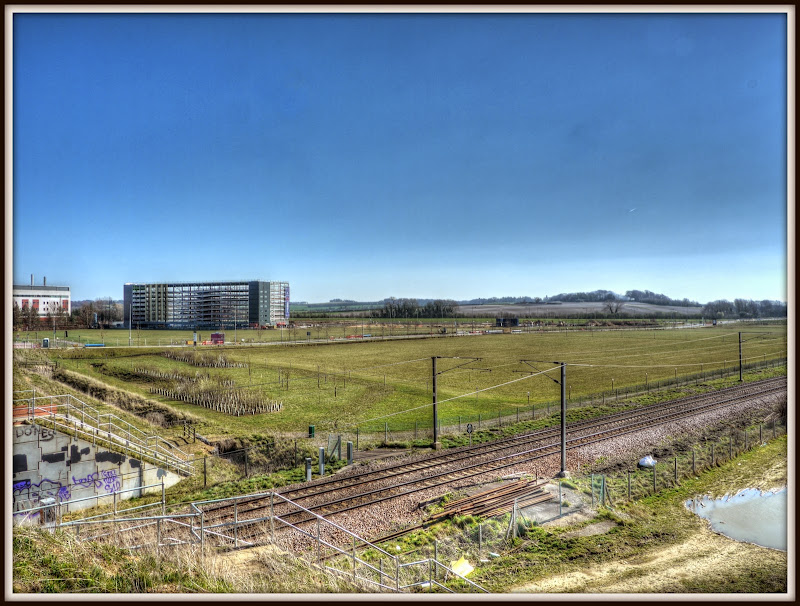
The CGB bridge over the railway line provides a good vantage point – here is the site of the new Country Park. Why do they plant in such rigid lines? It is totally unnatural.
Great Kneighton – Country Park – in the making

This is the view looking back towards the Addenbrookes site across the railway line. That building that looks rather like a multi-storey car park is indeed a new MSCP – under construction. It has capacity for 1,228 cars and will serve the new Papworth Hospital (if it doesn’t get side-tracked to Peterborough.
New Addenbrookes Multi-Storey Car Park
I then cycled along the CGB Cycleway to the Trumpington Park and Ride car park. Clearly there is significant demand for cycle parking here. I have wondered quite how it is used. Are these stored here for Park & Riders to park during the week and then cycle to their work in Cambridge?
Cycle Parking well utilised at the Trumpington Park and Ride

Getting out of the Trumpington P&R and then heading down the Hauxton Road into Cambridge not that straightforward on a bicycle. The pavement is shared-use – but the signage is random and the junctions seem a bit random from a cyclist’s point of view. The lines you end up cycling are not that obvious, well not to me. The Waitrose junction doesn’t seem to be light-controlled for pedestrians and cyclists. Even worse the junction into Trumpington Meadows has a traffic island with a dog-leg in the middle. I found myself having to brake hard as I approached the kerb. (Here is the Cyclestreets view of the junction and here is another.)
Frankly I reckon that it is p*ss-poor design section of shared-use cycleway and symptomatic of the way in which cyclists and pedestrians are treated as second-class citizens. I suppose one saving grace is that there is a Primary School – Trumpington Meadows – although I can't find anything on their website about cycling to school or what facilities they have for cycle parking and how they prioritise children over cars.
I then headed down Maris Lane to Grantchester. On a busy day it isn’t the most pleasant of cycle routes. I was following another cyclist down the road and we had a couple of cars follow us. The road wiggles quite a bit. To be fair to the driver behind he didn’t crowd me or lunge for impossible spaces. The trouble is such behaviour isn’t unusual. So although I am fairly long in the tooth as a cyclist and with reasonable number of miles under my belt I feel more intimidated on the British Roads than I used to. I think it is a combination of more congestion and busier people on the roads. I also feel that the attitude towards cyclists on the roads, amongst a small group of cyclists has become dangerously less tolerant.
Now this feeling may well be fuelled by the fact that I read about other cyclist’s near misses on the road and I am just more sensitive to the potential dangers. In general cycling is a safe activity and good for you. However I do feel that there has been an increase in the aggression on the roads from drivers. The same also goes for careless drivers. I wonder whether part of the problem is that the road-scape has become more complex. Mind you this road rage driver seems to have a track record.
When I started driving there were fewer things to consider when driving. Nowadays the streets are more complex, for instance roundabouts have traffic lights, some part-time, some full time. There are junctions in Cambridge which are traffic-light controlled, however there can be multiple traffic lights facing in the same direction, although when they go green they have an arrow to indicate which lane can go. The roads have information painted on them. Although I am sure than many cyclists will point to hoe poorly maintained cycle path markings are.
There has been a significant increase in the number of road signs in use. Apparently there were just 10 signs in the second edition of the Highway Code. The first edition of the highway code consisted of 18 pages of advice, the 2007 edition consisted of 135 pages of advice. There was a paper on Traffic Signs – Traffic Signs Policy Paper, DoT, October 2011. Which looks are the issue. My concern is not strictly one of Street Clutter, but rather motorists are hit by information overload. Indeed the issue is one considered by scientists for jobs that require the processing of lots of visual information.
Apparently at least 10 cars a week have tried to drive along the guided busway in Trumpington after being confused by road closures. This seems unbelievable (from a driver’s point of view) but it shows how drivers can easily suffer from information overload. The more stuff there is to watch out for when driving the grater the risk of having an accident. It is not unusual to hear about cars travelling the wrong way on majors roads – “Car spotted going wrong way on A14 near Newmarket”. Once might be careless but if it happens too often then surely the design of the road system has got to be improved.
We already know how dangerous it is to use a mobile phone when driving, (although many people still do and some even get caught – >500,000). Eating when driving can also distract the driver with can result in tragic consequences. We also have more motoring laws to attempt to deal with inconsiderate driving.
I do wonder if the complexity of the modern road system is one reason for why I feel that as a cyclist I suffer from more near misses from motorists. When it happens it is awful and it definitely triggers the “fight or flight response”. Which is perhaps why you sometimes hear quite a lot of swearing from cyclists after a terrifying near miss.
I also wonder whether the way the roads are are policed and justice administered also need to be re-considered. I can’t help but feel that the Police seem to take a car-centric view of the roads. However here in Cambridge they are reported as indicating they will only carry out speed checks in Cambridge's citywide 20mph zone in ‘exceptional circumstances’. We have “The Government committed to reining in over-zealous parking enforcement and unjust parking practices”
We also here reports like this of “Father is allowed to keep driving with 16 points on his licence – so he can keep his daughter at private school”. I must has missed the bit where the right to drive was deemed an inviolable Human Right. We also have “people campaigning against Police Speed Traps”.
I won’t even mention how uneven the application of the law seems to be – such as in this tragic case of a driver being cleared of causing death by driving without due care and attention because of the blinding sun.
So maybe there needs to a re-think, a lot of technology in cars seems to be focused at getting us out of trouble or mitigating it – such as Traction Control, Electronic Stability Control, Anti-Lock Braking. and air-bags. Maybe there needs to be more emphasis on it stopping us even getting there in the first place. Isn’t it about time that car systems were able to track and ensure compliance with the speed limit. I’d like to see compulsory black boxes in cars and more effort on helping us to be better and calmer drivers. (Mind you I also reckon that there needs to be more emphasis on making cities car-free and a renewed focus on more efficient and effective forms of transport.
In the meantime how are cyclists lives being “protected” – posters. There are of course reasons why the Government Cycle safety posters are returning to Cambridge. Apparently the first outing was a success, although the success was based upon drivers reporting it reminded them to look out for cyclists, rather than a reduction in the number of accidents.
I can’t help but feel that the success was it was a very cheap way for the Government (and the Department for Transport) to appear to care and to get a good soundbite. The trouble is that cyclists are vulnerable road users and whilst motorists moan about potholes damaging their cars, the effect for cyclists can be horrific – such as this schoolboy who broke his collar bone, or this man who broke is elbow.
Talking about signage, this short section of the Coton path is one of the few segregated cycle / pedestrian routes in Cambridge. There seems to be a reluctance to provide dedicated cycling facilities. Even the path alongside the Guided Busway is a shared use path.
The good bits are that it is segregated and in my experience cyclists stick to their bit and pedestrians to theirs. The two paths are marked with a ‘cycle’ and ‘pedestrian’ – although the markings never seem to last that long. On this stretch there are also four poles with signs showing which side is which. There are also lampposts.
The challenge comes because this also provides an entrance to the Cavendish Labs and so their is a very mild speed bump – plus ridges set in the direction of travel. Am I the only cyclist who detests these – especially in the wet. They make my wheels skit all over the place. The best approach is to travel over them at speed – which seems to be counter to the intended effect of slowing down cyclists.
It is only 0.5mile in length though and the bit round th4e bend towards the M11 bridge is rather rutted and needs a bit of care on a bicycle.
Coton Path – segregated cycle and pedestrian paths

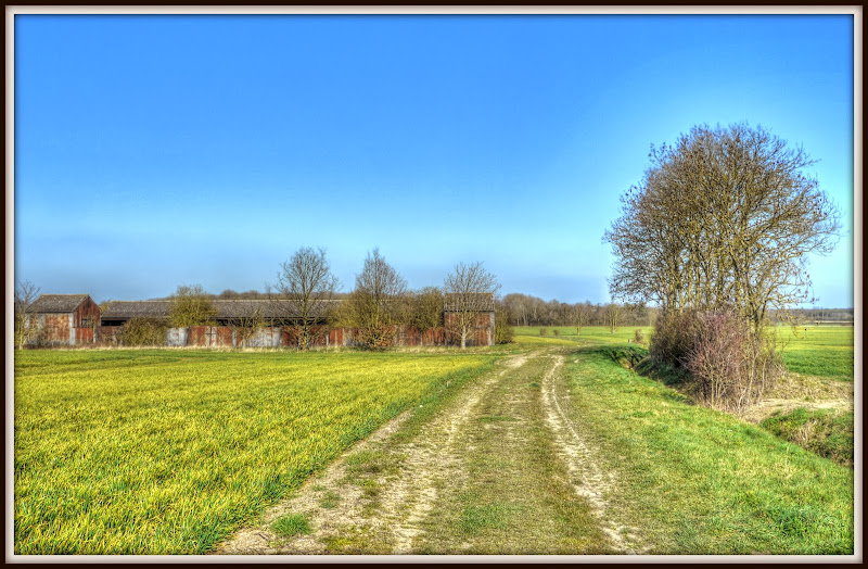
I then headed out towards the American Military Cemetery and a bridleway towards Girton. this is a beautiful bit of slightly undulating countryside.
The view from Madingley Wood
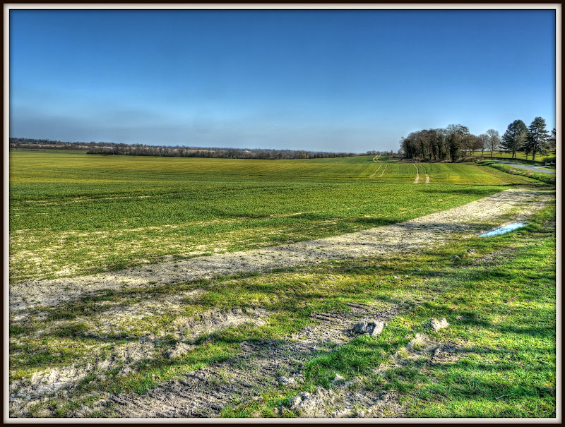
The view from Madingley Wood
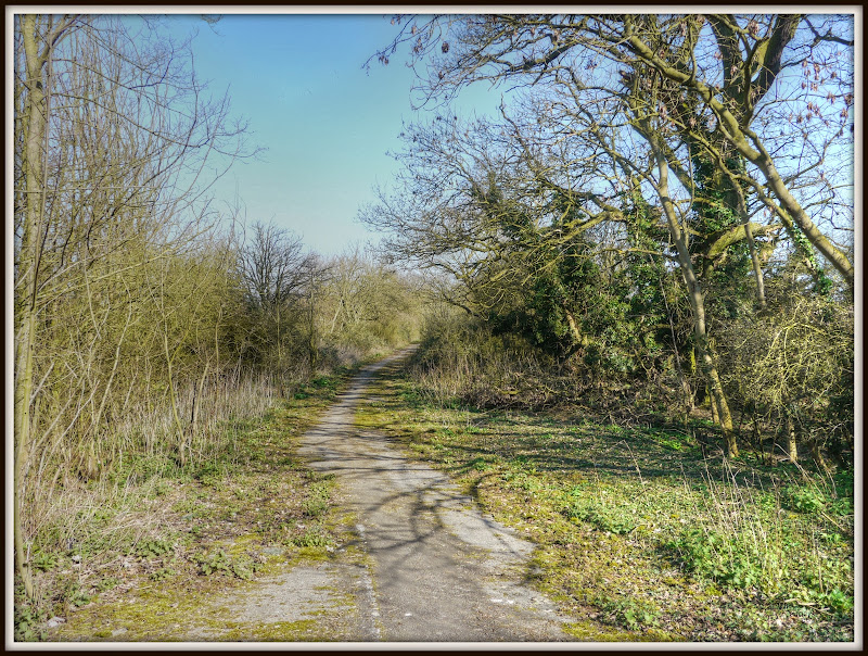
The route is a track, as I mentioned along a bridleway,for horses, but bicycles are permitted. Apart from it being close to the A428/A14 and M11 this would be a great place to renovate and turn into a place to live – I’d plant a fair bit of woodland in the field with paths and cycle tracks though.
Bridleway to Girton Interchange
The bridleway take you over the A428, with a reasonable bridge – so although only been pony-trekking once in my life I could imagine it is possible. Then you carry on to a tunnel under the M11 and the A14 feeder road. Rather stark and as often is the case a target for a bit of urban graffiti. I am ambivalent about graffiti – I dislike it on trains or in my face, but the odd bit of remote graffiti on what is a rather stark construction in the first place adds a bit of colour.
Bridleway under the A14
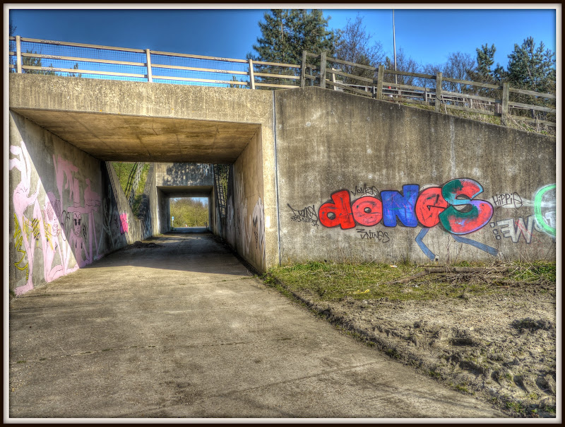
This is rather stark graffiti mind.
Bridleway under the A14
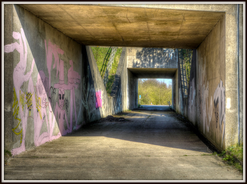
Amusing but unaspiring graffiti. They ought to take a leaf out of the Girton Youth Project.
Bridleway under the A14

Now bridleways are rights of way, by foot, horse or cycle. Unfortunately although the bridleway seems to extend to the far side of the interchange. It isn’t quite clear - check out this Streetmaps view which shows it stopping. It still means that even to get to the end of the bridleway a horse rider would need to cross the Huntingdon Road to A14 feeder road – which would be pretty tough even with a perfect horse. Clearly most riders would even dream of doing it.
If you want to walk the route, there is a pavement on the far side – which you can see here. Although there are also roadworks taking place. I do use it and cycle across and I will admit to cycling on the pavement. Why – well I personally reckon that it is too dangerous a stretch of road to hang around on and so I head up to Washpit Road.
I believe that the junction is being upgraded – will this be another example of how roads, through feature creep, gradually close off routes for pedestrians, cyclists and horse riders, by intimidation? Perhaps as part of the upgrade there ought a safe way for the area to be crossed – bridge or tunnel say?
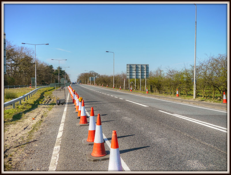
I can’t readily find a plan of the work – but it will add another lane to cross. Will this remove the pavement? the works will last until November 2014. Ah here is a link to the “new improved” Girton Interchange map. No-one seems to mention what will happen to the bridleway though? Speed the cars through but stuff the locals seems to be the message!
Roadworks on the Girton Exchange – will it seal off the paths across it?
Washpit Lane (Girton) – going nowhere?
If you look at the map, I did cycle back via Butt Lane, I can’t say that I am impressed with resulting cycleway, which is sort-of finished. Butt Lane is a fast road, despite the speed limit, the shared-use path isn’t very wide at the Milton end and frankly it is pathetic.
If we are going to have cycle ways alongside roads like that then there needs to be a safe separation. I can’t see this encouraging parents to get their children cycling between Milton and the school in Impington. Although to be fair I haven’t actually checked it out during the school run hours.
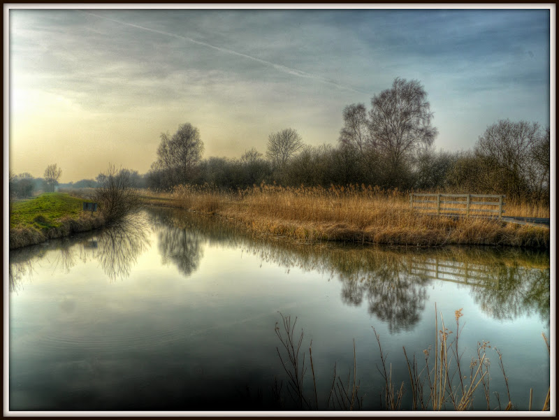
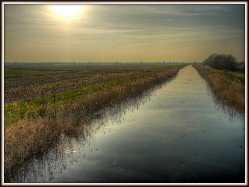
I cycled back via the route alongside the River Cam. It was supposed to be NCN11 from Cambridge up through Ely. It seems to have been an aspiration too far as the last bit between Waterbeach and White Fen has not been completed. Ah well even on a busy weekend the River Cam section makes for a pleasant ride.
Rowing on the River Cam


